bfastSpatial
Loïc Dutrieux, Ben DeVries, Jan Verbesselt
You've just downloaded Landsat data; you're 3 lines of code away from a change map
Why we built bfastSpatial
- Automate things that we were doing routinely
- Streamline pre-processing and analysis
- Because it's fun!!!
Overall it makes dealing with Landsat data for change detection more efficient and more accessible
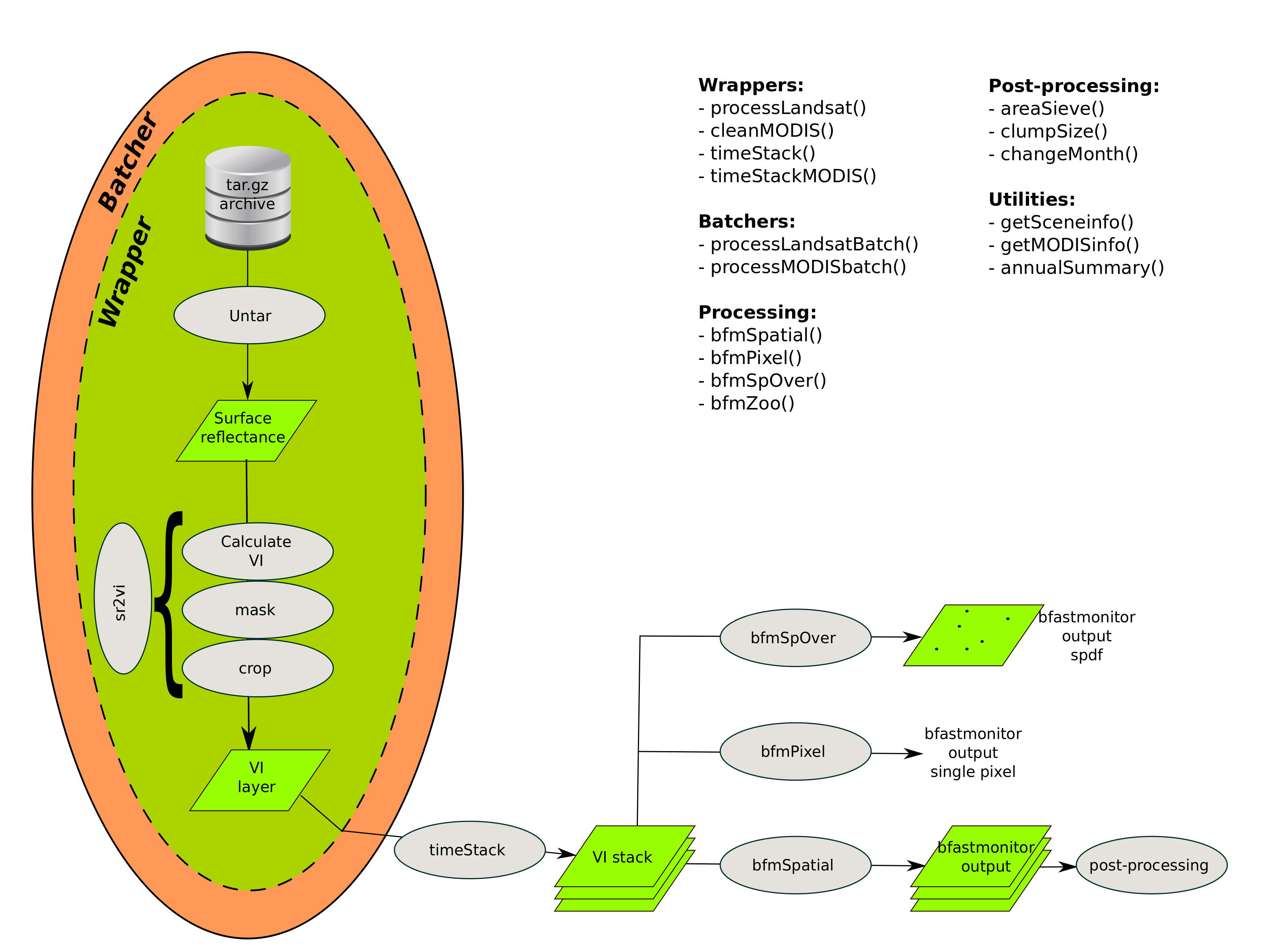
Classical data pre-processing and analysis chain
- Download the data
- Unpack the data
- Atmospheric correction and orthorectification
- Cloud masking
- Calculation of vegetation indices
- Prepare time-series
- Run algorithm
With bfastSptial we've tried to streamline this process
Enough theory, let's try it!!!
Installation
You need:
- (A recent version of) R
- The devtools package
# update existing R packages
#! the line below can potentially download lot's of R packages!
update.packages(checkBuilt = TRUE, ask = FALSE)
# install devtools package
install.packages('devtools')
Then we can install the package using the devtools package
# install bfastSpatial from github
devtools::install_github('dutri001/bfastSpatial')
About the data
- These are Surface reflectance Landsat data downloaded via espa
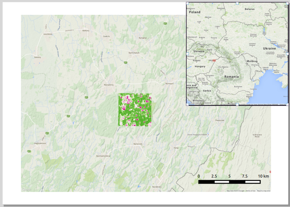
- The full time-series (2000-2015) of a 5x5 km extent was downloaded
- The product already contains vegetation indices (NDVI, NDMI, etc), processed by the USGS
- For a tutorial on how to order data from USGS and download them, refer to the main bfastSpatial tutorial
At the border between Romania and Hungary
A preproducible example
Utilities: Investigate individual pixel time-series
- bfmPixel() (run bfastmonitor on individual pixels)
- Validation via timeSyncR
bfmPixel() example
# Plot a cloud free recent NDVI layer
plot(ndviStack, 394)

# Call bfmPixel in interactive mode
bfmPixel(x = ndviStack, start = 2010, monend = 2013, interactive = TRUE, plot = TRUE)

# Click on a pixel
And what about validation?
We have a tool for that too; try timeSyncR for visual interpretation of time-series
Conclusion
- Early steps of the pre-processing are very standard and can be automated
- It's easy to produce a change map
- But a good change map requires local tuning
- Spend some time looking at individual pixels
- Keep your projects well structured
Where to find help
- Github project page
- Main tutorial
- Wageningen change monitor web page
- Mail us: Loïc, Ben and I
Thanks!
http://changemonitor-wur.github.io/talks/bfastSpatial-2016/
Special thanks to Loïc Dutrieux and Ben DeVries for leading the BfastSpatial effort and also this presentation!